Global ecosystem typology
Alternative site for the Global ecosystem typology with additional information for ecosystem profiles and indicative maps.
This site is maintained by jrfep
M1.1 Seagrass meadows
Biome: M1. Marine shelf biome
Contributors:
(texts)
These shallow, subtidal systems are the only marine ecosystems with an abundance of flowering plants. They are typically found mostly on soft, sandy or muddy substrates around relatively sheltered coastlines. Extent is limited in the shallows by wave action and tidal exposure, and at depth by light availability. Productive ecosystems, their three-dimensional structure provides shelter for juvenile fish, invertebrates and epiphytic algae. Diverse organisms live in and around seagrass beds including many grazers, from tiny invertebrates to megafauna such as dugongs.
Key Features
Soft, mostly subtidal substrates in low-energy waters with abundant vascular macrophytes, associated epibiota, infauna and fish.
Overview of distribution
Shallow tropical- temperate nearshore waters.
Profile versions
- v1.0 (2020-01-20):
- v2.0 (2020-05-27): MJ Bishop; AH Altieri; SN Porter; RJ Orth; DA Keith
- v2.01 ():
- v2.1 (2022-04-06): MJ Bishop; AH Altieri; SN Porter; RJ Orth; DA Keith Full profile available at official site
Main references
Selected references for this functional group:
De Boer WF (2007) Seagrass–sediment interactions, positive feedbacks and critical thresholds for occurrence: a review Hydrobiologia 591: 5-24 DOI:10.1007/s10750-007-0780-9
Orth RJ, Carruthers TJ, Dennison WC, Duarte CM, Fourqurean JW, Heck KL, Hughes AR, Kendrick GA, Kenworthy WJ, Olyarnik S, Short F (2006) A global crisis for seagrass ecosystems. Bioscience 56: 987-996.
Larkum WD, Orth RJ, Duarte CM (2006) Seagrasses: biology, ecology and conservation (Springer: The Netherlands)
Van der Heide T, Govers LL, De FouwJ, Olff H, van der Geest M, van Katwijk MM, Piersma T, van de Koppe Jl, Silliman BR, Smolders AJP, van Gils JA (2012) A three-stage symbiosis forms the foundation of seagrass ecosystems Science 336,1432-1434
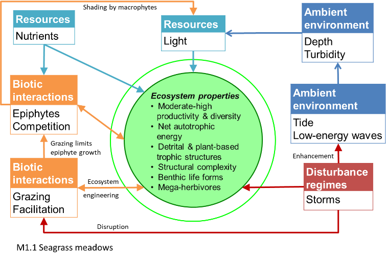
Diagrammatic assembly model

Maps
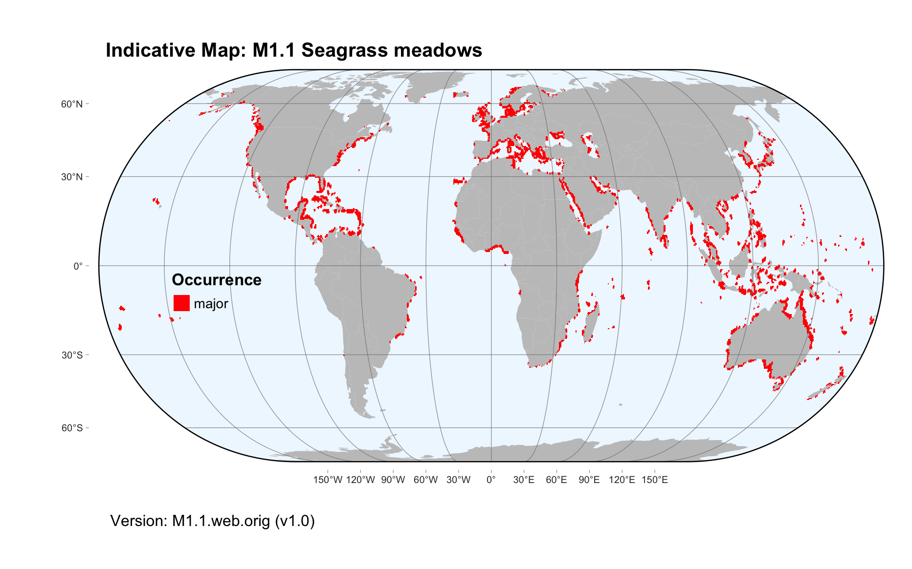
Maps are indicative of global distribution patterns are not intended to represent fine-scale patterns. The maps show areas of the world containing major (coloured red) or minor occurrences (coloured yellow) of each ecosystem functional group. See general notes on maps.
There are 2 alternative versions of the indicative map for this functional group, please compare description and sources below.
M1.1.IM.orig_v1.0
Datasets
- WCMCseegrass2018
Map references
Green EP, Short FT (2003) World atlas of seagrasses World atlas of seagrasses UNEP World Conservation Monitoring Centre. University of California Press, Berkeley. Available on-line at WCMC, Internet Archive or BHL
M1.1.web.orig_v1.0

Datasets
- WCMCseegrass2018
Map references
Green EP, Short FT (2003) World atlas of seagrasses World atlas of seagrasses UNEP World Conservation Monitoring Centre. University of California Press, Berkeley. Available on-line at WCMC, Internet Archive or BHL
Check: the Glossary / Profile structure / the public document