Global ecosystem typology
Alternative site for the Global ecosystem typology with additional information for ecosystem profiles and indicative maps.
This site is maintained by jrfep
M1.7 Subtidal sand beds
Biome: M1. Marine shelf biome
Contributors:
(texts)
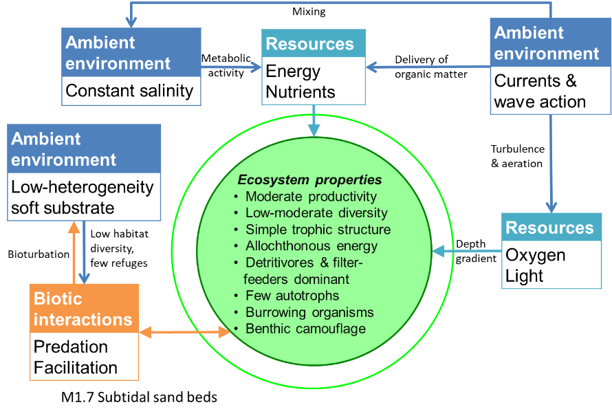
These relatively unstable shelf ecosystems in turbulent waters support moderately diverse communities made up largely of consumers, like invertebrate detritivores and filter-feeders, including burrowing polychaetes, crustaceans, echinoderms, and molluscs. Filter feeders are most common in higher energy areas of currents and wave action. Primary producers are limited by substrate instability or light, with seagrass ecosystems (M1.1) occurring where these factors are not limiting to plant establishment and persistence. Low structural habitat complexity means a lack of shelter, and many organisms display predator avoidance traits like burrowing, shells or camouflage (e.g. sole).
Key Features
Medium to coarse-grained soft sediment with burrowing invertebrate detrivores and suspension-feeders mostly relying on allochthonous energy..
Overview of distribution
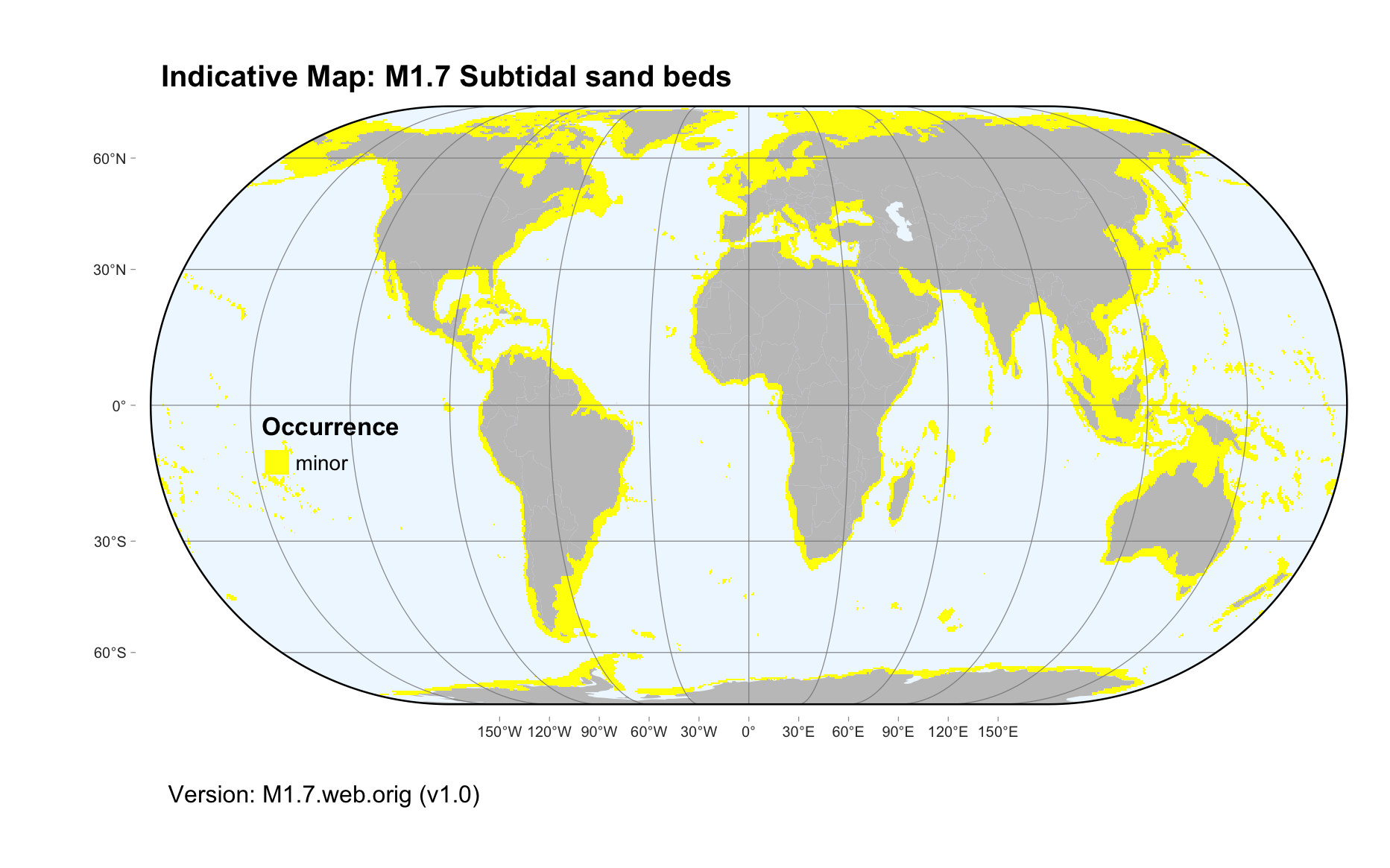
Continental and island shelves.
Profile versions
- v1.0 (2020-01-20): BA Polidoro; DA Keith
- v2.0 (2020-05-27): BA Polidoro; SE Swearer; DA Keith
- v2.01 ():
- v2.1 (2022-04-06): BA Polidoro; SE Swearer; DA Keith Full profile available at official site
Main references
Selected references for this functional group:
Byers JE, Grabowski JH (2014) Soft-sediment communities Marine community ecology and conservation (Eds. MD Bertness, JF Bruno, BR Silliman, JJ Stachowicz), pp227-249. Sinauer, Sunderland
Snelgrove PVR (1999) Getting to the bottom of marine biodiversity: sedimentary habitats Bioscience 49: 129-138 DOI:10.2307/1313538
Diagrammatic assembly model

Maps
Maps are indicative of global distribution patterns are not intended to represent fine-scale patterns. The maps show areas of the world containing major (coloured red) or minor occurrences (coloured yellow) of each ecosystem functional group. See general notes on maps.
There are 2 alternative versions of the indicative map for this functional group, please compare description and sources below.
M1.7.IM.orig_v1.0
Datasets
- GSFM-2014
Map references
Harris PT, Macmillan-Lawler M, Rupp J, Baker EK (2014) Geomorphology of the oceans. Marine Geology 352: 4-24. 10.1016/j.margeo.2014.01.011
M1.7.web.orig_v1.0

Datasets
- GSFM-2014
Map references
Harris PT, Macmillan-Lawler M, Rupp J, Baker EK (2014) Geomorphology of the oceans. Marine Geology 352: 4-24. 10.1016/j.margeo.2014.01.011
Check: the Glossary / Profile structure / the public document