Global ecosystem typology
Alternative site for the Global ecosystem typology with additional information for ecosystem profiles and indicative maps.
This site is maintained by jrfep
M2.1 Epipelagic ocean waters
Biome: M2. Pelagic ocean waters biome
Contributors:
(texts)
This uppermost ocean layer (0-200m depth) is the most influenced by the atmosphere, and is defined and structured by light availability. Photosynthesis in these ecosystems accounts for half of all global carbon fixation. That productivity supports diverse marine life, including many visual predators, like tuna, that rely on the high light environment. Migration is a common life history trait across all groups: either vertical – rising from the depths to feed at the surface at night to evade daytime predators; or horizontal – between breeding and feeding grounds. Detritus from this zone is an important nutrient source for lower oceanic layers.
Key Features
Uppermost euphotic ocean, where phytoplankton production supports abundant mobile zooplankton, fish, cephalopods, mammals and seabirds.
Overview of distribution
Surface layer of the open ocean.
Profile versions
- v1.0 (2020-01-20): KE Watermeyer; DA Keith
- v2.0 (2020-05-27): KE Watermeyer; RR Rykaczewski; IG Priede; TT Sutton; DA Keith
- v2.01 ():
- v2.1 (2022-04-06): KE Watermeyer; RR Rykaczewski; IG Priede; TT Sutton; DA Keith Full profile available at official site
Main references
Selected references for this functional group:
Sutton TT (2013) Vertical ecology of the pelagic ocean: Classical patterns and new perspectives Journal of Fish Biology 83: 1508‐1527
Stal LJ (2016) The euphotic realm The Marine Microbiome (Eds. LJ Stal, MS Cretoiu), pp. 209-225. Springer, Switzerland.
Anderson TR, Martin AP, Lampitt RS, Trueman CN, Henson SA, Mayor D J (2019) Quantifying carbon fluxes from primary production to mesopelagic fish using a simple food web model ICES Journal of Marine Science 76, 690–701
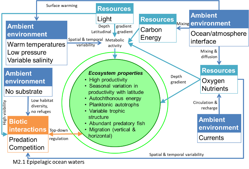
Diagrammatic assembly model

Maps
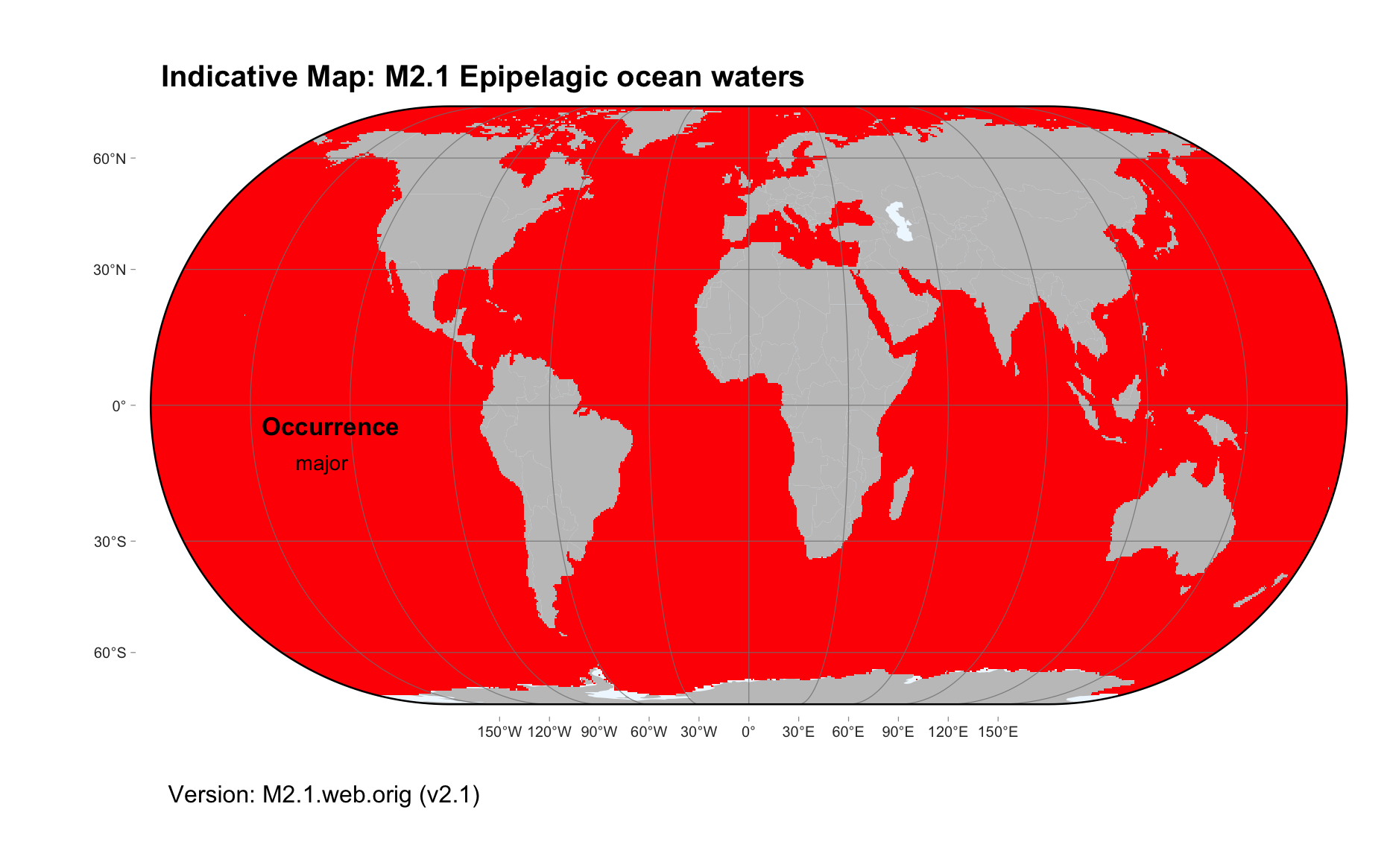
Maps are indicative of global distribution patterns are not intended to represent fine-scale patterns. The maps show areas of the world containing major (coloured red) or minor occurrences (coloured yellow) of each ecosystem functional group. See general notes on maps.
There are 2 alternative versions of the indicative map for this functional group, please compare description and sources below.
M2.1.IM.orig_v2.1
Datasets
- SRTM30-PLUS-V11
Map references
Becker JJ, Sandwell DT, Smith WHF, Braud J, Binder B, Depner J, Fabre D, Factor J, Ingalls S, Kim S-H, Ladner R, Marks K, Nelson S, Pharaoh A, Trimmer R, Von Rosenberg J, Wallace G, Weatherall P (2009) Global Bathymetry and Elevation Data at 30 Arc Seconds Resolution: SRTM30_PLUS, Marine Geodesy 32: 355-371. DOI:10.1080/01490410903297766
M2.1.web.orig_v2.1

Datasets
- SRTM30-PLUS-V11
Map references
Becker JJ, Sandwell DT, Smith WHF, Braud J, Binder B, Depner J, Fabre D, Factor J, Ingalls S, Kim S-H, Ladner R, Marks K, Nelson S, Pharaoh A, Trimmer R, Von Rosenberg J, Wallace G, Weatherall P (2009) Global Bathymetry and Elevation Data at 30 Arc Seconds Resolution: SRTM30_PLUS, Marine Geodesy 32: 355-371. DOI:10.1080/01490410903297766
Check: the Glossary / Profile structure / the public document