Global ecosystem typology
Alternative site for the Global ecosystem typology with additional information for ecosystem profiles and indicative maps.
This site is maintained by jrfep
M2.3 Bathypelagic ocean waters
Biome: M2. Pelagic ocean waters biome
Contributors:
(texts)
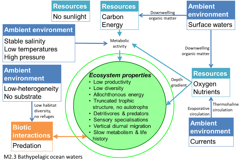
These deep (~1000-3000m depth), open-ocean ecosystems receive no sunlight and rely on detritus from upper layers for nutrients. Other resources such as oxygen are replenished via the ‘global ocean conveyer belt’ (thermohaline circulation) that starts when distant, polar surface waters cool and sink. With no primary producers, life is limited to groups like zooplankton, jellyfish, crustaceans, cephalopods and fish like the gulper eel. Common adaptations that enable animals to live under high pressure and no light include slow metabolism, long generation lengths and low density bodies.
Key Features
Lightless, high pressure depths where adapted zooplankton, crustaceans, jellies, cephalopods and fish rely on nutrients falling from above.
Overview of distribution
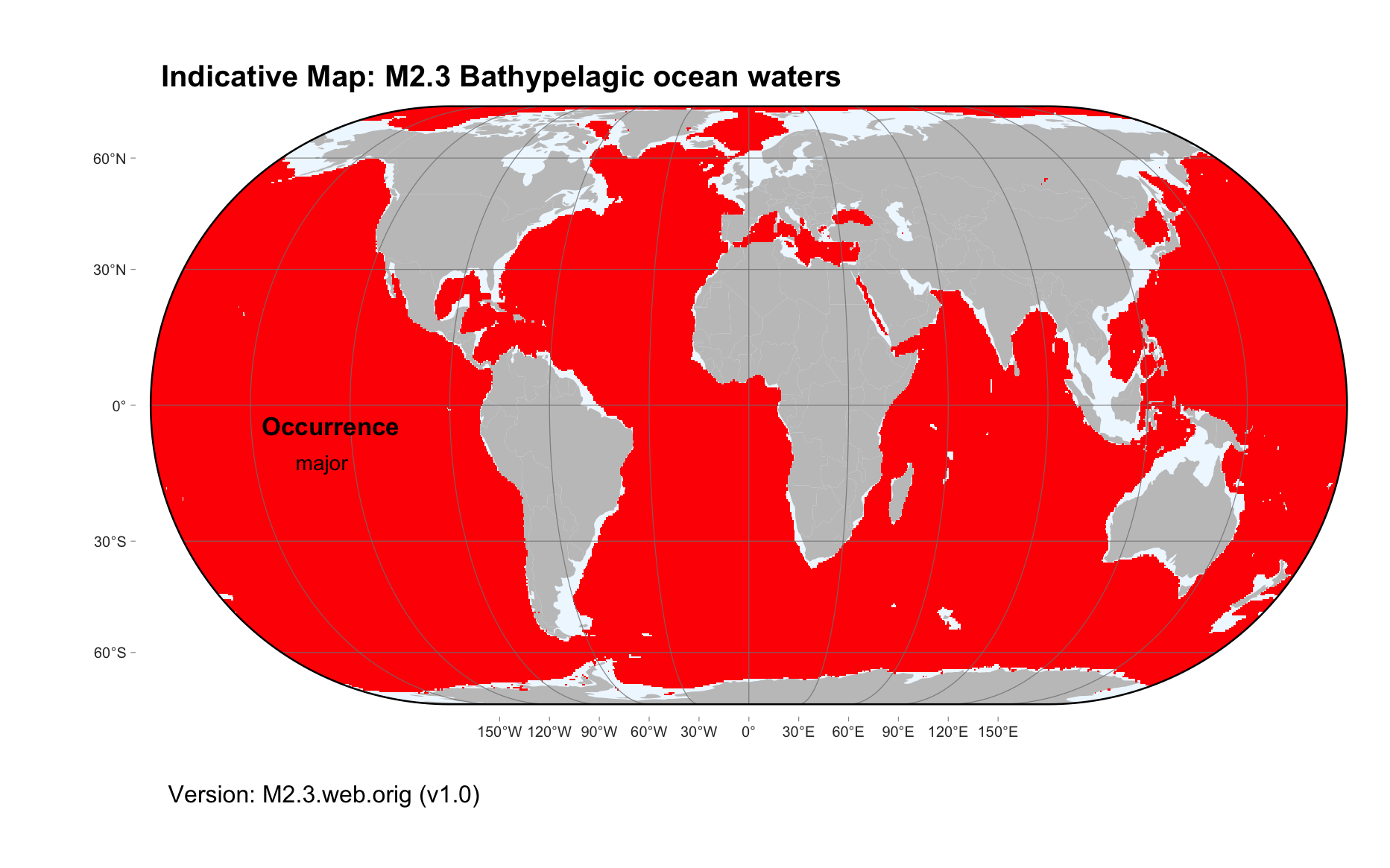
Deep oceans between 1000 - 3000m.
Profile versions
- v1.0 (2020-01-20): C Linardich; DA Keith
- v2.0 (2020-05-27): C Linardich; TT Sutton; IG Priede; DA Keith
- v2.01 ():
- v2.1 (2022-04-06): C Linardich; TT Sutton; IG Priede; DA Keith Full profile available at official site
Main references
Selected references for this functional group:
Priede, IG (2017) Deep-sea fishes: Biology, diversity, ecology and fisheries Chapter 1. Cambridge University Press, Cambridge DOI:10.1017/9781316018330
Diagrammatic assembly model

Maps
Maps are indicative of global distribution patterns are not intended to represent fine-scale patterns. The maps show areas of the world containing major (coloured red) or minor occurrences (coloured yellow) of each ecosystem functional group. See general notes on maps.
There are 2 alternative versions of the indicative map for this functional group, please compare description and sources below.
M2.3.IM.orig_v1.0
Datasets
- SRTM30-PLUS-V11
Map references
Becker JJ, Sandwell DT, Smith WHF, Braud J, Binder B, Depner J, Fabre D, Factor J, Ingalls S, Kim S-H, Ladner R, Marks K, Nelson S, Pharaoh A, Trimmer R, Von Rosenberg J, Wallace G, Weatherall P (2009) Global Bathymetry and Elevation Data at 30 Arc Seconds Resolution: SRTM30_PLUS, Marine Geodesy 32: 355-371. DOI:10.1080/01490410903297766
M2.3.web.orig_v1.0

Datasets
- SRTM30-PLUS-V11
Map references
Becker JJ, Sandwell DT, Smith WHF, Braud J, Binder B, Depner J, Fabre D, Factor J, Ingalls S, Kim S-H, Ladner R, Marks K, Nelson S, Pharaoh A, Trimmer R, Von Rosenberg J, Wallace G, Weatherall P (2009) Global Bathymetry and Elevation Data at 30 Arc Seconds Resolution: SRTM30_PLUS, Marine Geodesy 32: 355-371. DOI:10.1080/01490410903297766
Check: the Glossary / Profile structure / the public document