Global ecosystem typology
Alternative site for the Global ecosystem typology with additional information for ecosystem profiles and indicative maps.
This site is maintained by jrfep
M2.5 Sea ice
Biome: M2. Pelagic ocean waters biome
Contributors:
(texts)
These seasonally frozen surface waters in polar oceans are one of the most dynamic ecosystems on earth. The sea-ice itself provides habitat for ice-dependent species, such as the microalgal and microbial communities that form the basis of communities in waters below, while plankton, fish and marine birds and mammals feed on and around the ice. Sea-ice plays a crucial role in both pelagic marine ecosystems and biogeochemical processes like ocean-atmosphere gas exchange.
Key Features
Highly dynamic, seasonally frozen surface waters support diverse ice-associated organisms from plankton to seabirds and whales.
Overview of distribution
Polar oceans.
Profile versions
- v1.0 (2020-01-20): JS Stark; DA Keith
- v2.0 (2020-06-15): JS Stark; DA Keith
- v2.01 ():
- v2.1 (2022-04-06): JS Stark; DA Keith Full profile available at official site
Main references
Selected references for this functional group:
Brierley AS, Thomas DN (2002) Ecology of Southern Ocean pack ice Advances in Marine Biology 43: 171-276. Academic Press DOI:10.1016/s0065-2881(02)43005-2
Arrigo KR, Thomas DN (2004) Large scale importance of sea ice biology in the Southern Ocean Antarctic Science 16: 471-486 DOI:10.1017/s0954102004002263
Horner R., Ackley, SF, Dieckmann GS, Gulliksen B, Hoshiai T, Legendre L, Melnikov IA, Reeburgh WS, Spindler M, Sullivan CW (1992) Ecology of sea ice biota Polar Biology 12: 417-427
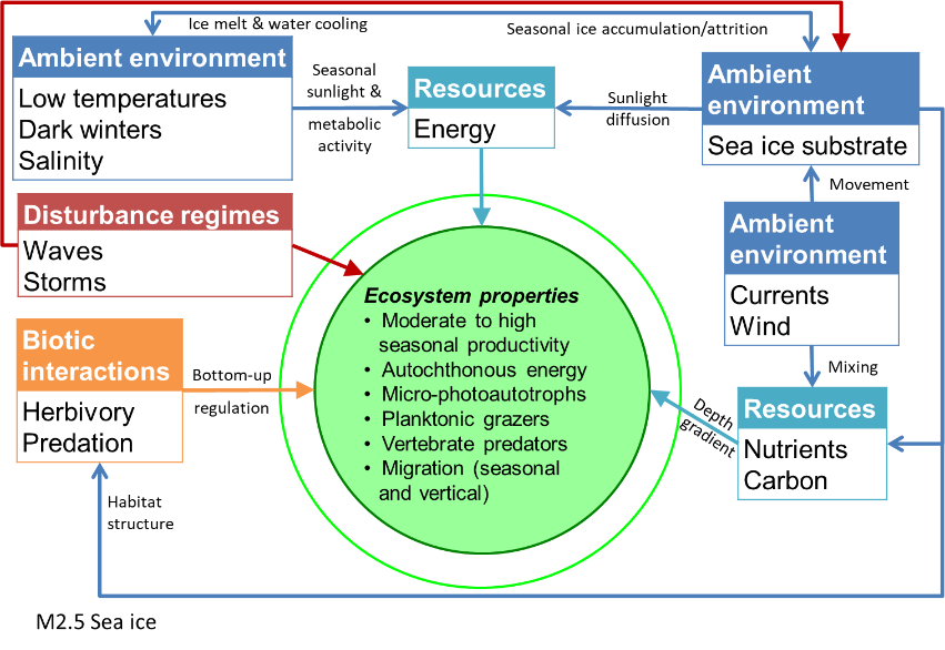
Diagrammatic assembly model

Maps
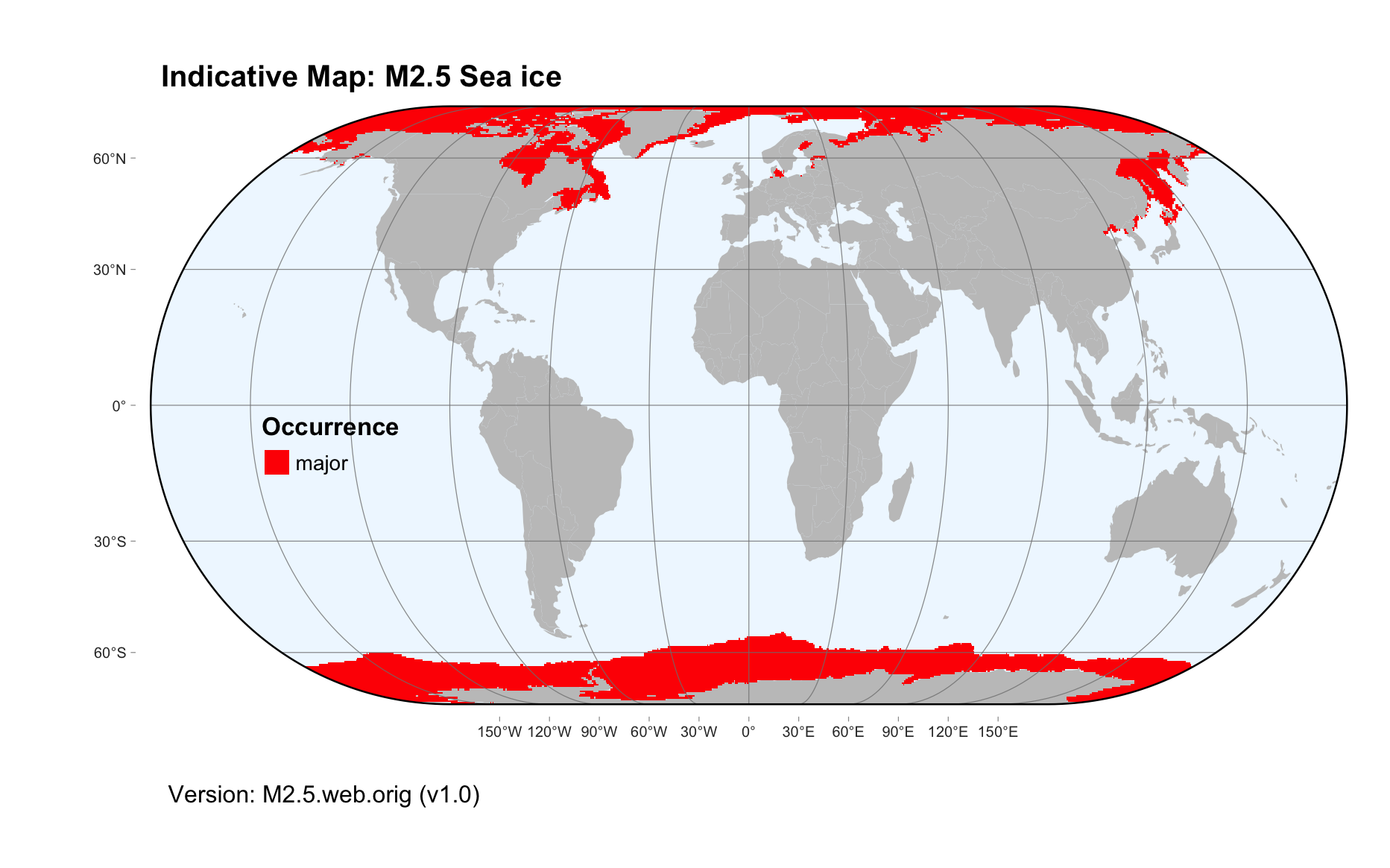
Maps are indicative of global distribution patterns are not intended to represent fine-scale patterns. The maps show areas of the world containing major (coloured red) or minor occurrences (coloured yellow) of each ecosystem functional group. See general notes on maps.
There are 2 alternative versions of the indicative map for this functional group, please compare description and sources below.
M2.5.IM.orig_v1.0
Datasets
- G02135-Sea-Ice-3.0
Map references
Fetterer F, Knowles K, Meier WN, Savoie M, Windnagel AK (2017) Sea Ice Index, Version 3. Monthly Sea Ice Extent NSIDC: National Snow and Ice Data Center Boulder, Colorado USA. Updated daily, Accessed September 2019 DOI:10.7265/N5K072F8
M2.5.web.orig_v1.0

Datasets
- G02135-Sea-Ice-3.0
Map references
Fetterer F, Knowles K, Meier WN, Savoie M, Windnagel AK (2017) Sea Ice Index, Version 3. Monthly Sea Ice Extent NSIDC: National Snow and Ice Data Center Boulder, Colorado USA. Updated daily, Accessed September 2019 DOI:10.7265/N5K072F8
Check: the Glossary / Profile structure / the public document