Global ecosystem typology
Alternative site for the Global ecosystem typology with additional information for ecosystem profiles and indicative maps.
This site is maintained by jrfep
M3.6 Hadal trenches and troughs
Biome: M3. Deep sea floors biome
Contributors:
(texts)
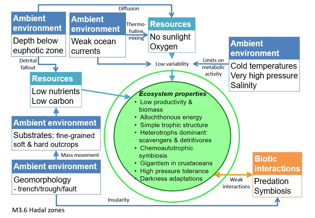
The deepest ocean trenches, up to 11 km beneath the surface, are the least explored marine ecosystems. They are also one of the most extreme, with no sunlight, low temperatures, nutrient scarcity and hydrostatic pressures of 600 to 1100 atmospheres, extending beyond the limits to vertebrate life. The major sources of nutrients and carbon are fallout from upper layers, drifts of fine sediment and landslides. Most organisms are scavengers and detrivores, like the supergiant amphipod, with abundance of predatory fish and crustaceans diminishing with depth.
Key Features
Deepest ocean systems, poorly explored, mostly of fine nutrient-poor sediment dominated by scavangers and detritivors.
Overview of distribution
Seafloor between 6000 and 11 000 m.
Profile versions
- v1.0 (2020-01-20): E Ramirez-Llodra; AA Rowden; AJ Jamieson; DA Keith
- v2.0 (2020-05-28): E Ramirez-Llodra; AA Rowden; AJ Jamieson; IG Priede; DA Keith
- v2.01 ():
- v2.1 (2022-04-06): E Ramirez-Llodra; AA Rowden; AJ Jamieson; IG Priede; DA Keith Full profile available at official site
Main references
Selected references for this functional group:
Jamieson A, Fujii T, Mayor DJ, Solan M, Priede IG (2010) Hadal trenches: the ecology of the deepest places on Earth Trends in Ecology and Evolution 25: 190-197 DOI:10.1016/j.tree.2009.09.009
Stewart HA, Jamieson AJ (2018) Habitat heterogeneity of hadal trenches: considerations and implications for future studies Progress in Oceanography 161: 47-65 DOI:10.1016/j.pocean.2018.01.007
Diagrammatic assembly model

Maps
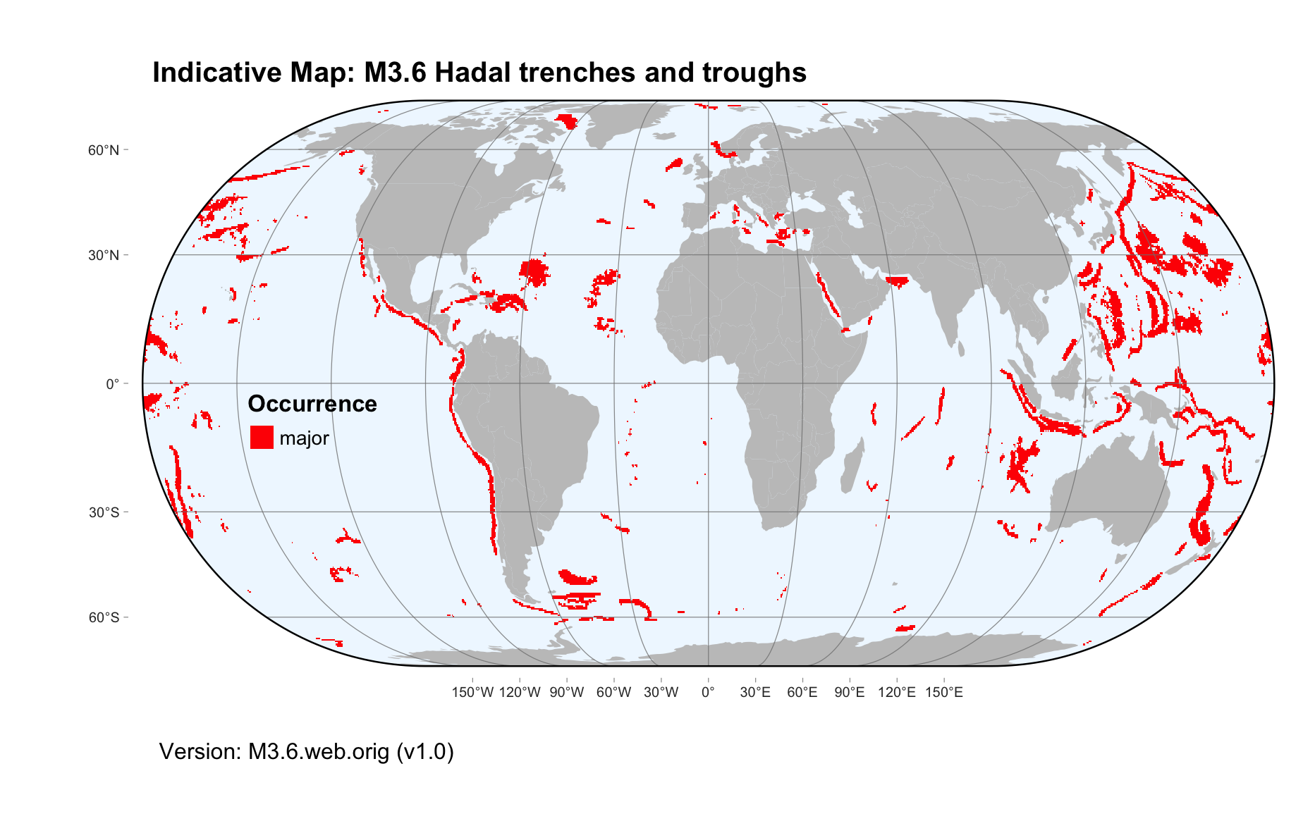
Maps are indicative of global distribution patterns are not intended to represent fine-scale patterns. The maps show areas of the world containing major (coloured red) or minor occurrences (coloured yellow) of each ecosystem functional group. See general notes on maps.
There are 2 alternative versions of the indicative map for this functional group, please compare description and sources below.
M3.6.IM.orig_v1.0
Datasets
- GSFM-2014
Map references
Harris PT, Macmillan-Lawler M, Rupp J, Baker EK (2014) Geomorphology of the oceans. Marine Geology 352: 4-24. 10.1016/j.margeo.2014.01.011
M3.6.web.orig_v1.0

Datasets
- GSFM-2014
Map references
Harris PT, Macmillan-Lawler M, Rupp J, Baker EK (2014) Geomorphology of the oceans. Marine Geology 352: 4-24. 10.1016/j.margeo.2014.01.011
Check: the Glossary / Profile structure / the public document