Global ecosystem typology
Alternative site for the Global ecosystem typology with additional information for ecosystem profiles and indicative maps.
This site is maintained by jrfep
MT1.2 Muddy Shorelines
Biome: MT1. Shorelines biome
Contributors:
(texts)
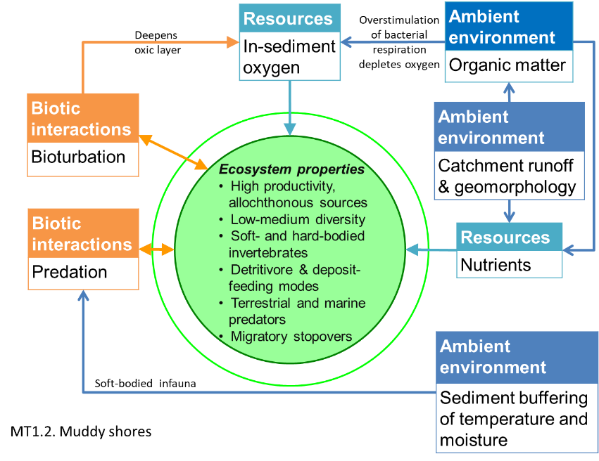
Mudflats occur on low-energy coastlines. Mud and silt, often from nearby rivers, protect the burrowing organisms living in these ecosystems from common shoreline stressors (e.g. high temperatures and desiccation) and predatory shorebirds, crabs and fish. These shorelines are critical stopovers and foraging grounds for migratory shorebirds. Primary productivity is mostly from diatoms (single-celled algae) that rely on tides. Oxygen can be low where sediments are very fine or burrowing or other disturbance is limited.
Key Features
Intertidal soft-sediment, of fine particle-size, dependent on allochtonous production and dominated by deposit feeding and detritivorous invertebrates that provide a prey resource for shore birds and fishes.
Overview of distribution
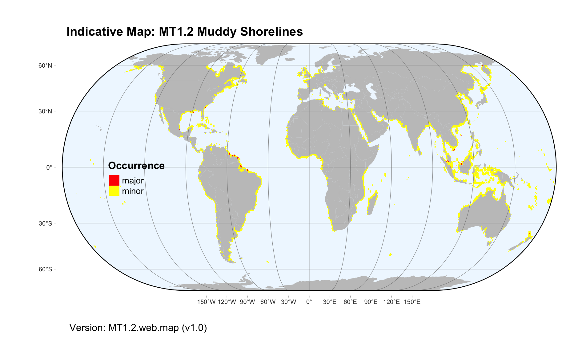
Low-energy shorelines globally.
Profile versions
- v1.0 (2020-01-20): MJ Bishop; NJ Murray; DA Keith
- v2.0 (2020-07-28): MJ Bishop; NJ Murray; SE Swearer; DA Keith
- v2.01 ():
- v2.1 (2022-04-06): MJ Bishop; NJ Murray; SE Swearer; DA Keith Full profile available at official site
Main references
Selected references for this functional group:
Peterson CH (1991) Intertidal zonation of marine invertebrates in sand and mud American Scientist 79:236-249. URL
Wilson WH (1990) Competition and predation in marine soft-sediment communities. Annual Review of Ecology and Systematics 21:221-41. DOI:10.1146/annurev.es.21.110190.001253
Murray NJ, Phinn SR, DeWitt M, Ferrari R, Johnston R, Lyons MB, Clinton N, Thau D, Fuller RA (2019) The global distribution and trajectory of tidal flats Nature 565: 222–225 DOI:10.1038/s41586-018-0805-8
Diagrammatic assembly model

Maps
Maps are indicative of global distribution patterns are not intended to represent fine-scale patterns. The maps show areas of the world containing major (coloured red) or minor occurrences (coloured yellow) of each ecosystem functional group. See general notes on maps.
There are 2 alternative versions of the indicative map for this functional group, please compare description and sources below.
MT1.2.IM.orig_v1.0
Datasets
- TidalFlats2019
Map references
Murray NJ, Phinn SR, DeWitt M, Ferrari R, Johnston R, Lyons MB, Clinton N, Thau D, Fuller RA (2019) The global distribution and trajectory of tidal flats Nature 565: 222–225 DOI:10.1038/s41586-018-0805-8
MT1.2.web.map_v1.0

Datasets
- TidalFlats2019
Map references
Murray NJ, Phinn SR, DeWitt M, Ferrari R, Johnston R, Lyons MB, Clinton N, Thau D, Fuller RA (2019) The global distribution and trajectory of tidal flats Nature 565: 222–225 DOI:10.1038/s41586-018-0805-8
Check: the Glossary / Profile structure / the public document