Global ecosystem typology
Alternative site for the Global ecosystem typology with additional information for ecosystem profiles and indicative maps.
This site is maintained by jrfep
SF1.2 Groundwater ecosystems
Biome: SF1. Subterranean freshwaters biome
Contributors:
(texts)
Low productivity ecosystems occur within water-saturated permeable rock strata or layers of buried unconsolidated sediments. Life in these dark, confined or connected ecosystems is almost completely comprised of microbial and small invertebrate detritivores and their protozoan consumers. Diversity and productivity decline with depth and connectivity to surface waters. Although groundwater ecosystems occur almost everywhere in the near surface crust, they are prominent below surface water and in artesian basins.
Key Features
Saturated ecosystems at or below the watertable with low diversity communities of heterotrophic microbes and invertebrates.
Overview of distribution
Scattered globally throughout land masses.
Profile versions
- v1.0 (2020-01-20): DA Keith
- v2.0 (2020-06-03): DA Keith; TM Iliffe; V Gerovasileiou; B Gonzalez; D Brankovits; A Martínez García; GC Hose
- v2.01 ():
- v2.1 (2022-04-06): DA Keith; TM Iliffe; V Gerovasileiou; B Gonzalez; D Brankovits; A Martínez García; GC Hose Full profile available at official site
Main references
Selected references for this functional group:
Danielopol DL, Griebler C, Gunatilaka A, Notenboom J (2003) Present state and future prospects for groundwater ecosystems Environmental Conservation 30: 104-130 DOI:10.1017/s0376892903000109
Hancock PJ Boulton AJ, Humphreys WF (2005) Aquifers and hyporheic zones: towards an understanding of groundwater Hydrogeology Journal 13: 98–111 DOI:10.1007/s10040-004-0421-6
Struckmeier W, Richts A (2008) Groundwater resources of the world BGR Hannover / UNESCO Paris. MAP
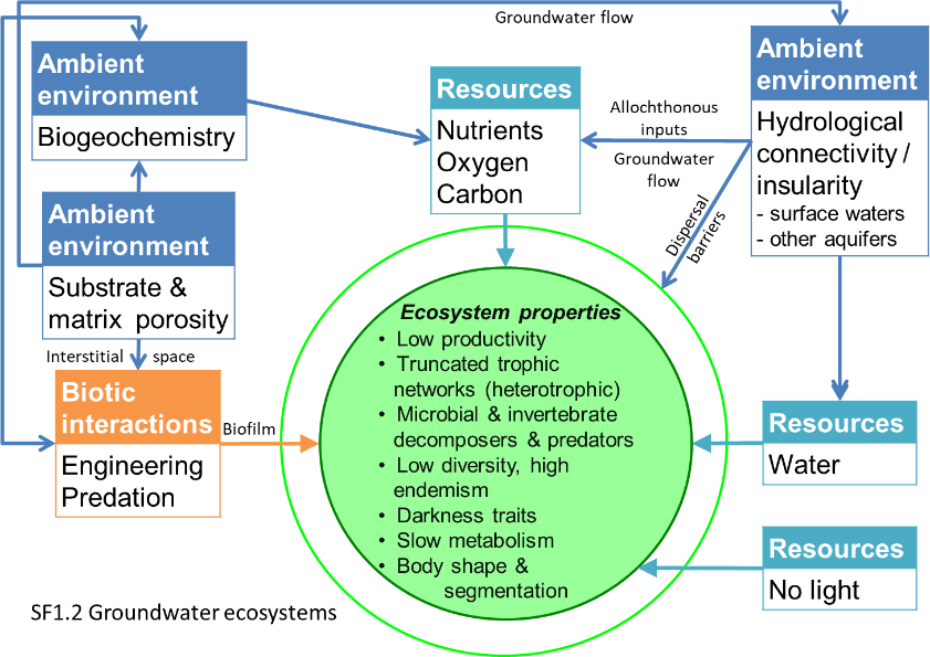
Diagrammatic assembly model

Maps
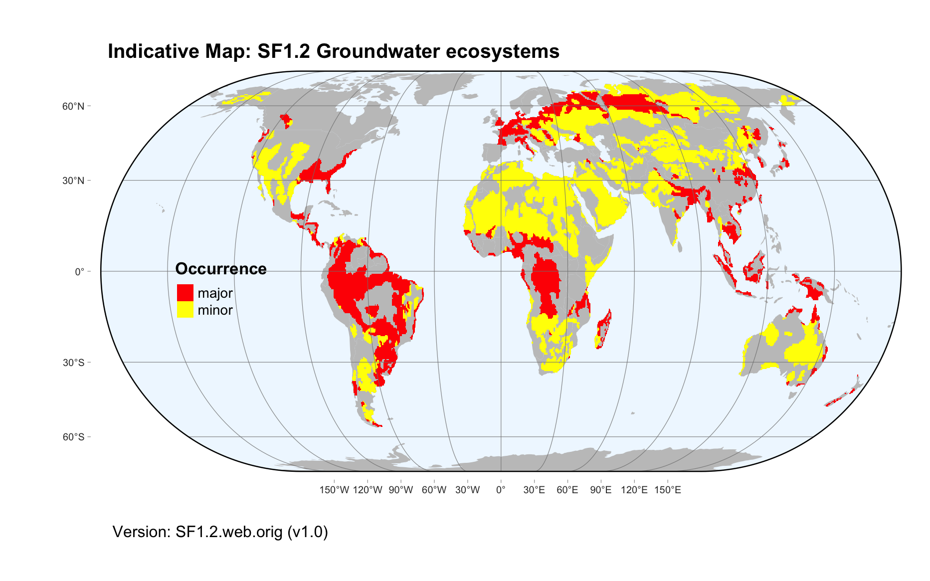
Maps are indicative of global distribution patterns are not intended to represent fine-scale patterns. The maps show areas of the world containing major (coloured red) or minor occurrences (coloured yellow) of each ecosystem functional group. See general notes on maps.
There are 2 alternative versions of the indicative map for this functional group, please compare description and sources below.
SF1.2.IM.orig_v1.0
Datasets
- BGR-Groundwater-Basins
Map references
Bundesanstalt für Geowissenschaften und Rohstoffe (BGR) & UNESCO (2012) River and Groundwater Basins of the World 1 : 50 000 000 – Hannover, Paris
SF1.2.web.orig_v1.0

Datasets
- BGR-Groundwater-Basins
Map references
Bundesanstalt für Geowissenschaften und Rohstoffe (BGR) & UNESCO (2012) River and Groundwater Basins of the World 1 : 50 000 000 – Hannover, Paris
Check: the Glossary / Profile structure / the public document