Global ecosystem typology
Alternative site for the Global ecosystem typology with additional information for ecosystem profiles and indicative maps.
This site is maintained by jrfep
SF2.1 Water pipes and subterranean canals
Biome: SF2. Anthropogenic subterranean freshwaters biome
Contributors:
(texts)
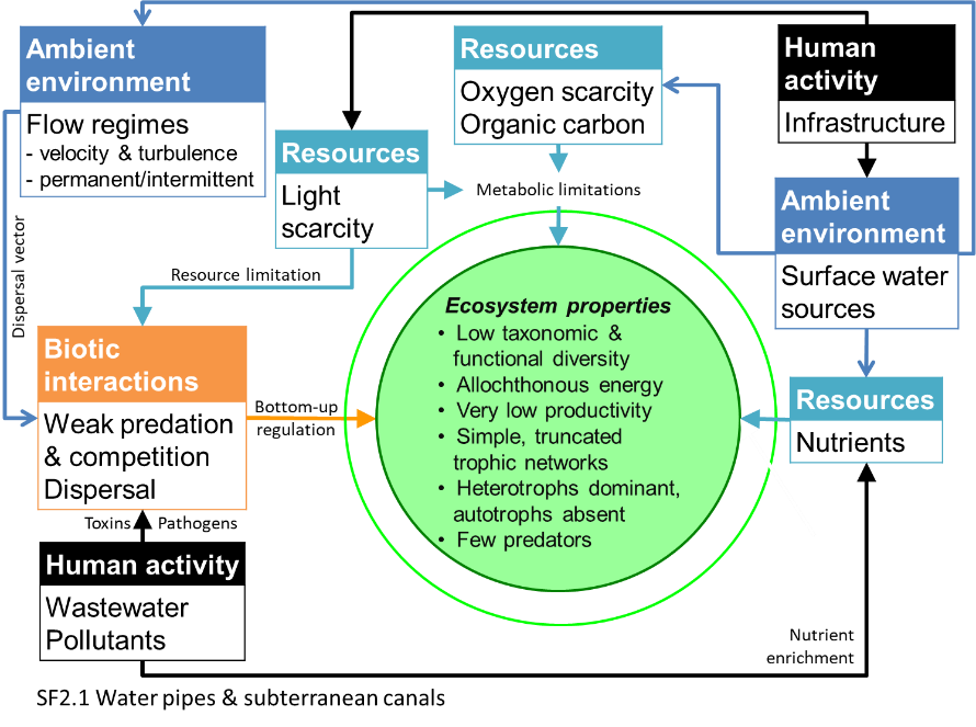
Waters flowing rapidly through artificial conduits are typically bereft of their own primary producers in the absence of light and rely on imported algae and detritus as sources of energy. These support simple bacterial and fungal communities in biofilms and largely itinerant invertebrates. Diversity, abundance and productivity are low, but filter feeders may colonise and productivity may be higher if source waters supply nutrients and organic carbon.
Key Features
Artificial flowing waterbodies that carry water with variable flow regime, limited light, sometimes with high carbon and nutrients supporting opportunities aquatic detritivores and predators.
Overview of distribution
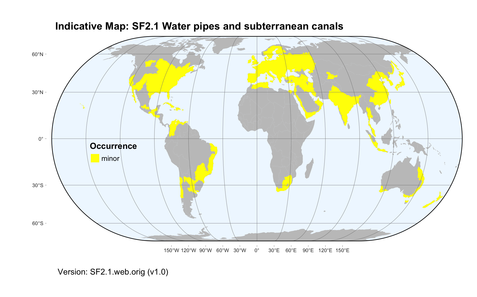
Ubiquitous in developed regions of the world, most commonly in urban landscapes and irrigation areas.
Profile versions
- v1.0 (2020-01-20): DA Keith
- v2.0 (2020-06-17): DA Keith; TM Iliffe; V Gerovasileiou; B Gonzalez; D Brankovits; A Martínez García
- v2.01 ():
- v2.1 (2022-04-06): DA Keith; TM Iliffe; V Gerovasileiou; B Gonzalez; D Brankovits; A Martínez García Full profile available at official site
Main references
Selected references for this functional group:
Douterelo I, Sharpe RL, Boxall JB (2013) Influence of hydraulic regimes on bacterial community structure and composition in an experimental drinking water distribution system Water Research 47, 503-516 DOI:10.1016/j.watres.2012.09.053
Diagrammatic assembly model

Maps
Maps are indicative of global distribution patterns are not intended to represent fine-scale patterns. The maps show areas of the world containing major (coloured red) or minor occurrences (coloured yellow) of each ecosystem functional group. See general notes on maps.
There are 2 alternative versions of the indicative map for this functional group, please compare description and sources below.
SF2.1.IM.orig_v1.0
Datasets
- FEOW-2008
Map references
Abell R, Thieme ML, Revenga C, Bryer M, Kottelat M, Bogutskaya N, Coad B, Mandrak N, Contreras Balderas S, Bussing W, Stiassny MLJ, Skelton P, Allen GR, Unmack P, Naseka A, Ng R, Sindorf N, Robertson J, Armijo E, Higgins JV, Heibel TJ, Wikramanayake E, Olson D, López HL, Reis RE, Lundberg JG, Sabaj Pérez MH, Petry P (2008) Freshwater ecoregions of the world: A new map of biogeographic units for freshwater biodiversity conservation, BioScience 58: 403–414. DOI:10.1641/B580507
SF2.1.web.orig_v1.0

Datasets
- FEOW-2008
Map references
Abell R, Thieme ML, Revenga C, Bryer M, Kottelat M, Bogutskaya N, Coad B, Mandrak N, Contreras Balderas S, Bussing W, Stiassny MLJ, Skelton P, Allen GR, Unmack P, Naseka A, Ng R, Sindorf N, Robertson J, Armijo E, Higgins JV, Heibel TJ, Wikramanayake E, Olson D, López HL, Reis RE, Lundberg JG, Sabaj Pérez MH, Petry P (2008) Freshwater ecoregions of the world: A new map of biogeographic units for freshwater biodiversity conservation, BioScience 58: 403–414. DOI:10.1641/B580507
Check: the Glossary / Profile structure / the public document