Global ecosystem typology
Alternative site for the Global ecosystem typology with additional information for ecosystem profiles and indicative maps.
This site is maintained by jrfep
SM1.1 Anchialine caves
Biome: SM1. Subterranean tidal biome
Contributors:
(texts)
Anchialine caves contain water bodies that have a subterranean connection to the sea and no or little direct connection to the atmosphere. These ecosystems are structured by strong salinity gradients. A primarily marine community influenced by tides and currents at the cave entrance transitioning to a more insular and specialised biota in still brackish waters influenced by rainfall percolation deep in the landward section of the cave. They occur where carbonate rocks and lava tubes meet coastlines worldwide.
Key Features
Cave-bound waterbodies connected to the sea with a gradient of tidal influence and salinity. Filter feeders, scavengers and predators limited by light and nutrients.
Overview of distribution
Limestone, basalt and more rarely lithic substrates coastal regions globally.
Profile versions
- v1.0 (2020-01-20): DA Keith
- v2.0 (2020-06-17): TM Iliffe; D Brankovits; V Gerovasileiou; B Gonzalez; A Martínez García; DA Keith
- v2.01 ():
- v2.1 (2022-04-06): TM Iliffe; D Brankovits; V Gerovasileiou; B Gonzalez; A Martínez García; DA Keith Full profile available at official site
Main references
Selected references for this functional group:
Iliffe TM (2000) Anchialine cave ecology Ecosystems of the World. Vol. 30. Subterranean Ecosystems (Eds. H Wilkens, DC Culver, WF Humphreys), pp 59-76. Elsevier, Amsterdam. WorldCat entry
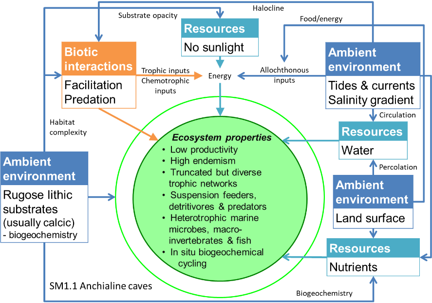
Diagrammatic assembly model

Maps
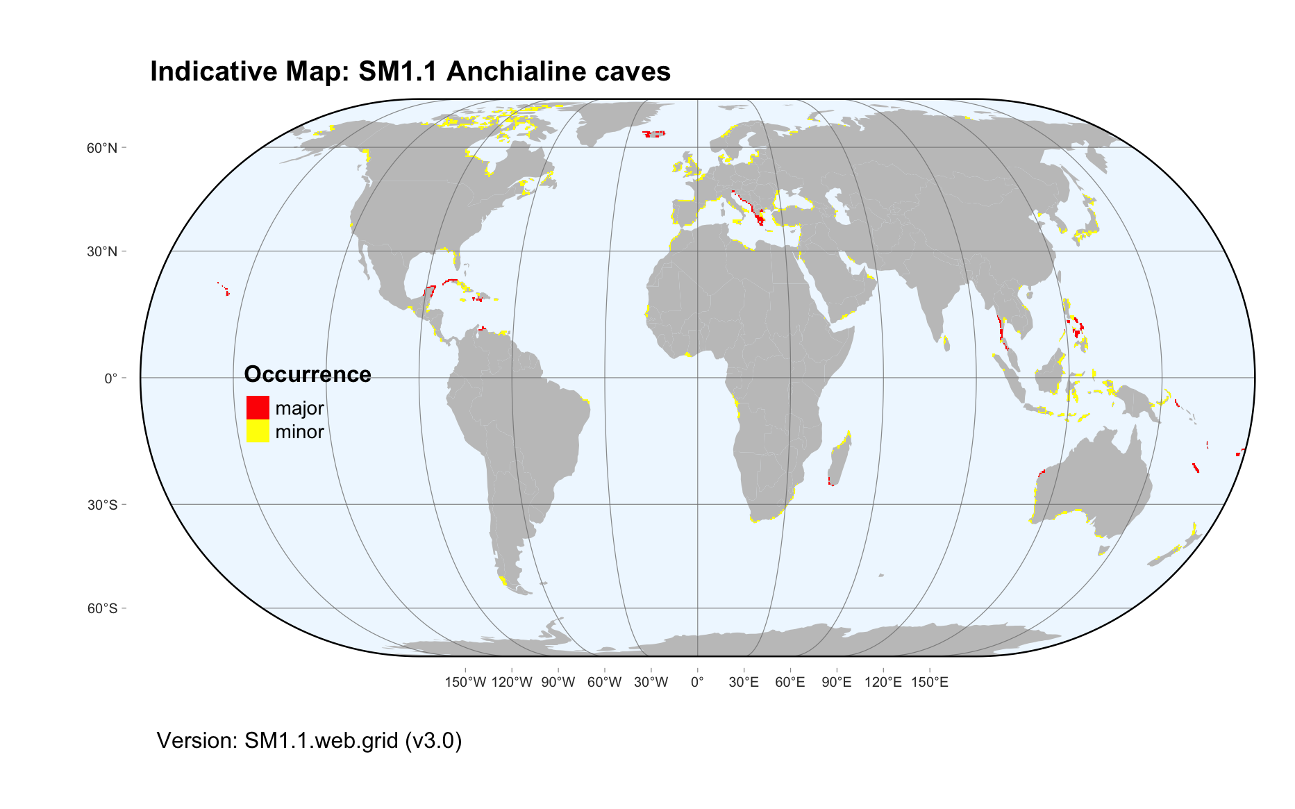
Maps are indicative of global distribution patterns are not intended to represent fine-scale patterns. The maps show areas of the world containing major (coloured red) or minor occurrences (coloured yellow) of each ecosystem functional group. See general notes on maps.
There are 2 alternative versions of the indicative map for this functional group, please compare description and sources below.
SM1.1.IM.grid_v3.0
Datasets
- Carbonate-rocks-3.0
- SRTM30-PLUS-V11
Map references
Williams P, Ting Fong Y (2016) World map of carbonate rock outcrops v3.0 The University of Auckland, Auckland. Webpage
Becker JJ, Sandwell DT, Smith WHF, Braud J, Binder B, Depner J, Fabre D, Factor J, Ingalls S, Kim S-H, Ladner R, Marks K, Nelson S, Pharaoh A, Trimmer R, Von Rosenberg J, Wallace G, Weatherall P (2009) Global Bathymetry and Elevation Data at 30 Arc Seconds Resolution: SRTM30_PLUS, Marine Geodesy 32: 355-371. DOI:10.1080/01490410903297766
SM1.1.web.grid_v3.0

Datasets
- Carbonate-rocks-3.0
Map references
Williams P, Ting Fong Y (2016) World map of carbonate rock outcrops v3.0 The University of Auckland, Auckland. Webpage
Check: the Glossary / Profile structure / the public document