Global ecosystem typology
Alternative site for the Global ecosystem typology with additional information for ecosystem profiles and indicative maps.
This site is maintained by jrfep
SM1.2 Anchialine pools
Biome: SM1. Subterranean tidal biome
Contributors:
(texts)
Anchialine pools are brackish surface water bodies that have a subterranean connection to the sea. They are associated with carbonate substrates and lava flows on the coast and have a stronger terrestrial influence than other subterranean systems. Exposure to the surface enables algal primary producers to inhabit the water column and the benthos. Diversity and productivity of these aquatic ecosystems increases with age and connectivity to the sea. Some anchialine pools are highly insular, with molluscs and crustacean species found nowhere else.
Key Features
Open pools with subterranean connections to the sea and groundwater, and dynamic, diverse trophic networks.
Overview of distribution
Limestone, basalt and more rarely lithic substrates coastal regions globally.
Profile versions
- v2.0 (2020-06-17): TS Sakihara; M Lamson; B Seidel; DM Sedar; S Santos; J Havird; TM Iliffe; DA Keith
- v2.01 ():
- v2.1 (2022-04-06): TS Sakihara; M Lamson; B Seidel; DM Sedar; S Santos; J Havird; TM Iliffe; DA Keith Full profile available at official site
Main references
Selected references for this functional group:
Becking LE, Renema W, Santodomingo NK, Hoeksema BW, Tuti Y, de Voogd NJ (2011) Recently discovered landlocked basins in Indonesia reveal high habitat diversity in anchialine systems Hydrobiologia 677, 89-105
Por FD (1985) Anchialine pools—comparative hydrobiology Hypersaline ecosystems pp. 136-144. Springer, Berlin, Heidelberg
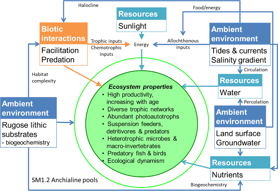
Diagrammatic assembly model

Maps
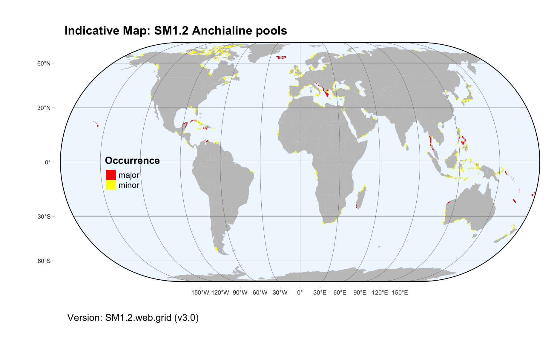
Maps are indicative of global distribution patterns are not intended to represent fine-scale patterns. The maps show areas of the world containing major (coloured red) or minor occurrences (coloured yellow) of each ecosystem functional group. See general notes on maps.
There are 2 alternative versions of the indicative map for this functional group, please compare description and sources below.
SM1.2.IM.grid_v3.0
Datasets
- SRTM30-PLUS-V11
- Carbonate-rocks-3.0
Map references
Becker JJ, Sandwell DT, Smith WHF, Braud J, Binder B, Depner J, Fabre D, Factor J, Ingalls S, Kim S-H, Ladner R, Marks K, Nelson S, Pharaoh A, Trimmer R, Von Rosenberg J, Wallace G, Weatherall P (2009) Global Bathymetry and Elevation Data at 30 Arc Seconds Resolution: SRTM30_PLUS, Marine Geodesy 32: 355-371. DOI:10.1080/01490410903297766
Williams P, Ting Fong Y (2016) World map of carbonate rock outcrops v3.0 The University of Auckland, Auckland. Webpage
SM1.2.web.grid_v3.0

Datasets
- Carbonate-rocks-3.0
Map references
Williams P, Ting Fong Y (2016) World map of carbonate rock outcrops v3.0 The University of Auckland, Auckland. Webpage
Check: the Glossary / Profile structure / the public document